


suuntoapp-SkiTouring-2024-11-09T07-46-12Z

jcolonnadelega
User

Length
9.4 km

Max alt
2444 m

Uphill gradient
1045 m
Km-Effort
23 km

Min alt
1447 m

Downhill gradient
1045 m
Boucle
Yes
Creation date :
2024-11-09 18:52:06.235
Updated on :
2024-11-10 11:47:05.912
5h17
Difficulty : Very difficult

FREE GPS app for hiking
 SityTrail
IGN / Geographical institutes
SityTrail Plus
The world is yours!
About
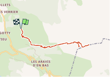
Trail Walking of 9.4 km to be discovered at Auvergne-Rhône-Alpes, Upper Savoy, La Clusaz. This trail is proposed by jcolonnadelega.
Description
grotte de l'Eglise des Fées

Positioning
Country:
France
Region :
Auvergne-Rhône-Alpes
Department/Province :
Upper Savoy
Municipality :
La Clusaz
Location:
Unknown
Start:(Dec)
Start:(UTM)
301311 ; 5085291 (32T) N.
Comments